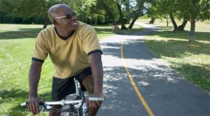
Greenways and Trails

Regional councils often coordinate planning for trails and greenways in Illinois. The plans are used extensively by local governments, environmental agencies and organizations, trail users, and corridor councils.
There are many benefits of greenways and trails that professional planners, funders, and the public need to know about: they make our communities more liveable; improve the economy through tourism and civic improvement; preserve and restore open space; and provide opportunities for physical activity to improve fitness and mental health.
ILLINOIS CASE STUDIES
Active Choices: Champaign County Greenways and Trails Plan (Champaign County RPC)
Active Choices seeks to foster interagency cooperation to implement the best greenways and trails system possible for Champaign County. The purpose of this plan update is to compile information and recommendations from active transportation and environmental plans and documents completed by Greenways and Trails (GT) member agencies since the 2004 Champaign County Greenways & Trails Plan. Click here.
Bike Share Feasibility Study (Rockford Metropolitan Agency for Planning)
The Rockford Metropolitan Agency for Planning (RMAP) researched the feasibility of a bike share program for City of Rockford as part of the update to the RMAP Bike and Pedestrian Plan, a federally required document. This report is organized into eight sections with a summary of findings, including potential strengths and limitations that might arise with the launch of a program. Click here.
Carbondale Bicycle Master Plan (Greater Egypt RPC)
The purpose of the Carbondale Bicycle Master Plan is to be a guide for the City, SIMPO, IDOT, SIU, and other partners to improve bicycling in Carbondale through additional facilities, education, encouragement, enforcement, and evaluation. The plan builds upon the existing positive momentum of improving bicycling in Carbondale. Click here.
City of Ottawa Park Acquisition and Development Plann (North Central Illinos COG)
The purpose of the City of Ottawa Park Plan is two-fold: first, to identify improvements and additional amenities needed at existing parks and second, to determine sites for future development and acquisition of new parks, open space and trails. Click here.
Clay County Greenways and Trails Pan (South Central Illinois RP&DC)
The Clay County Greenways and Trail Plan was completed during a 13-month process. It focuses on consensus building among stakeholders, and on planning and prioritizing improvements and additions to the existing network of trails and greenways within Clay County. Click here.
Greenways: A Green Infrastructure Plan for Boone and Winnebago Counties (RMAP)
Now in its fourth iteration, the Greenways Plan has laid the foundation for natural areas protection, balanced growth, and expanded transportation choices. This plan has led to the successful receipt of many grants within the region; from acquiring and restoring prime natural habitat, to connecting and adding shared-use path mileage. This plan has close linkages to broader community planning initiatives. Click here.
McDonough County Bike Study (Western Illinois Regional Council)
One purpose of this study was to determine where residents bicycle so if grant funds do become available, data will already exist that documents the current bicycle needs of the county and the perceptions of both experienced and novice cyclists on what improvements are needed to make the county more bicycle friendly in the future. Click here.
McDonough County Trails and Greenways Comprehensive Plan (Western Illinois Regional Council)
This Trails and Greenways Plan provides recommendations for conservation and recreational corridors of several kinds (driving routes, hiking trails, walking and bicycling, riding trails, and even air and water routes. The plan defines opportunities for connection with potential cooridors and sites in adjoining counties and ranks proposed trails and greenways to their need and feasibility. Click here.
Northeastern Illinois Regional Greenways and Trails Plan (CMAP)
The Northeastern Illinois Regional Greenways and Trails Plan presents a vision for a regional greenway and trail network to advance greenway preservation and reduce conflicts with other development activities. It assists implementers and funding agencies in allocating resources to projects. Proposals that relate to the plan can be more attractive to funding agencies. Click here.
Rural Sangamon County Bicycle and Pedestrian Plan (Springfield-Sangamon County RPC)
In August 2012 the Springfield Area Transportation Study (SATS) adopted a bicycle and pedestrian plan for the urban area of Sangamon County. Although this plan addressed the needs of bicyclists and walkers in the core of Sangamon County, there was an unnatural break in connectivity at the metropolitan planning area boundary. Recognizing the importance of creating a network of active travel accommodations throughout the county and into surrounding counties, the SSCRPC was able to utilize Rural Comprehensive Regional Planning funds from IDOT to create a similar plan for the rural areas of the county. Click here.
SATS Bicycle and Pedestrian Plan (Springfield-Sangamon County RPC)
A bicycle and pedestrian‐way plan for the Springfield Metropolitan Planning Area (MPA) by 2012 was an objective included in the Springfield Area Transportation Study (SATS) 2035 Long Range Transportation Plan (LRTP). The need for such a plan was suggested by the results of a citizen survey conducted as part of the public input activities for development of the LRTP. Click here.
PLANNING PROCESSES
BikeConnect HOI (Tri-County Regional Planning Commission)
BikeConnect HOI is a regional bicycle planning process for the greater Peoria area. The planning process will identify a proposed regional bicycle network within Peoria, Tazewell, and Woodford Counties. The primary focus of this regional planning process is to identify a proposed bicycle network that connects communities within the region. Learn more.
